Bukoba Travel and Desinations Guide
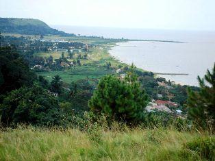
Bukoba is on the western shore of Lake Victoria in the extreme northwest of Tanzania. It is the regional capital and the largest town in the Kagera region, which borders Uganda to the north, Rwanda to the west, and Burundi to the southwest.
The climate is sunny and warm most of the year. Evenings can get cool but never cold. Rains occur almost every morning from March through May. It almost never rains in the p.m. hours.
People and Occupations
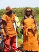
Bukoba has a population of about 100,000 people, and the Kagera region over one million. The main ethnic group of the region are the Bahaya, who speak Ruhaya.
(Most people in town speak Swahili, and basic English is understood at most shops.) The main occupation is agriculture, the main commercial product is coffee, and the main food crop and dietary staple is matoke (large green bananas that are roasted or steamed).
There are many NGOs, volunteers and other wazungu (ex-pats) in Bukoba and the surrounding area. A few travellers pass through from Mwanza (overnight by ferry) and Kampala (six hours by bus).
Orientation
Bukoba is a fairly small town and the centre of town is flat and compact, though many people and organisations are located in the surrounding hills.
Bukoba has a bay with a sandy beach, a port with a ferry that travels to Mwanza on Monday, Wednesday and Friday night and returns the following night.
It has a small airport with twice daily flights to Mwanza by Auric air, a bus stand, and numerous hotels and bars.
There are two main streets, both paved: Jamhuri Road goes from a cluster of old German buildings and government offices near the Lake Hotel to the centre of town where the market and the bus stand are located.
Government Road goes from the port to the town centre (about 3 km) and proceeds out of town to Kampala and Muleba.

More about Bukoba
Kasulu Town › | Kidika Town › | Kigoma Town › | Kilindoni Town › | Kilwa Masoko Town › | Koani Town › | Lindi Town › | Mahenge Town › | Manyoni Town › | Mbamba Town › | Mbeya Town › | Mikindani Town › | Town Schools and Colleges› | Dar es Salaam City Guide › | Zanzibar Visitors Guide › | Bukoba › | Attractions | Entertainment and Nightlife | Hospitals and Medical Services | Hotels and Lodges | Industries and Factories | People and Culture | Property and Real Estate | Locations and How to Travel | Schools and Colleges | Restaurants and Dining | Shopping Guide |Other Related Pages
Recent Articles
-
Garam Masala Appetizers ,How to Make Garam Masala,Kenya Cuisines
Sep 21, 14 03:38 PM
Garam Masala Appetizers are originally Indian food but of recent, many Kenyans use it. Therefore, on this site, we will guide you on how to make it easily. -
The Details of the Baruuli-Banyara People and their Culture in Uganda
Sep 03, 14 12:32 AM
The Baruuli-Banyala are a people of Central Uganda who generally live near the Nile River-Lake Kyoga basin. -
Guide to Nubi People and their Culture in Kenya and Uganda
Sep 03, 14 12:24 AM
The Nubians consist of seven non-Arab Muslim tribes which originated in the Nubia region, an area between Aswan in southern


New! Comments
Have your say about what you just read! Leave me a comment in the box below.